
Theatrum Statuum Regiae Celsitudinis Sabaudiae Ducis.
Willem e Joan Blaeu
Apud Hæredes Ioannis Blaeu
Amsterdam
1682
2 voll. in-folio (580 x 380 mm)
Inv. 0720
Catalogue N. A644
Description
Provenance
Well-known to scholars and historians of the Duchy of Savoy and 17th-century Dutch publishing, the Theatrum Sabaudiae is one of the works that best exemplify the political importance acquired by cartography in the modern era.1
Initiated in 1660 by the Blaeu firm of printers with the support of the young Duke Carlo Emanuele II under the regency of his mother Christine of France, it remains a monument to the drive for self-representation of a dukedom aspiring to the status of a kingdom and eager to display itself to the European powers in all its populous and orderly majesty. The duke had enthusiastically agreed to take part in Joan Blaeu’s project for a work on the major Italian cities (Teatro delle città più principali d’Italia2) with views of some of Piedmont’s most important urban centres. Very soon, however, also in view of delays in the delivery of the maps, they both realised the potential in terms of image and economic benefits of a work devoted solely to the Duchy of Savoy. Its sovereign’s regal aspirations are explicitly apparent in the title chosen for the work on its appearance in 1682.
The history of this venture and the long and painstaking gestation of the Theatrum affords insight into the practicalities and requirements of such a meticulously prepared production.3 Involved in the project were not only the finest cartographers, topographers, draughtsmen, landscape painters and engravers, starting with Tommaso Borgonio and Giovenale Boetto, but also the municipal authorities of the cities and towns included in a proud rivalry of expenditure and commitment on the part of many local craftsmen and workers.
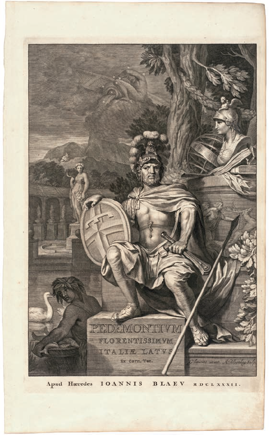
The Theatrum comprises a total of 145 plates, not all of which are signed. The first of the two volumes contains 71 plates, 34 of which devoted to the capital Turin, the city worthy of most attention, while the rest range from an allegorical image of Piedmont as a warrior on the banks of the Po (Allegoria del Piemonte, virile guerriero assiso sulle sponde del Po) and Borgonio’s large map of Piedmont all the way to the most important places in the province of Turin. The second volume contains 74 plates covering all the other provinces and cities of the duchy - from the transalpine region through most of the Piedmontese territory including the County of Nice and part of Monferrato obtained after the Treaty of Cherasco in 1631 - and starting with an allegorical identification of Savoy with the dynasty of that name.
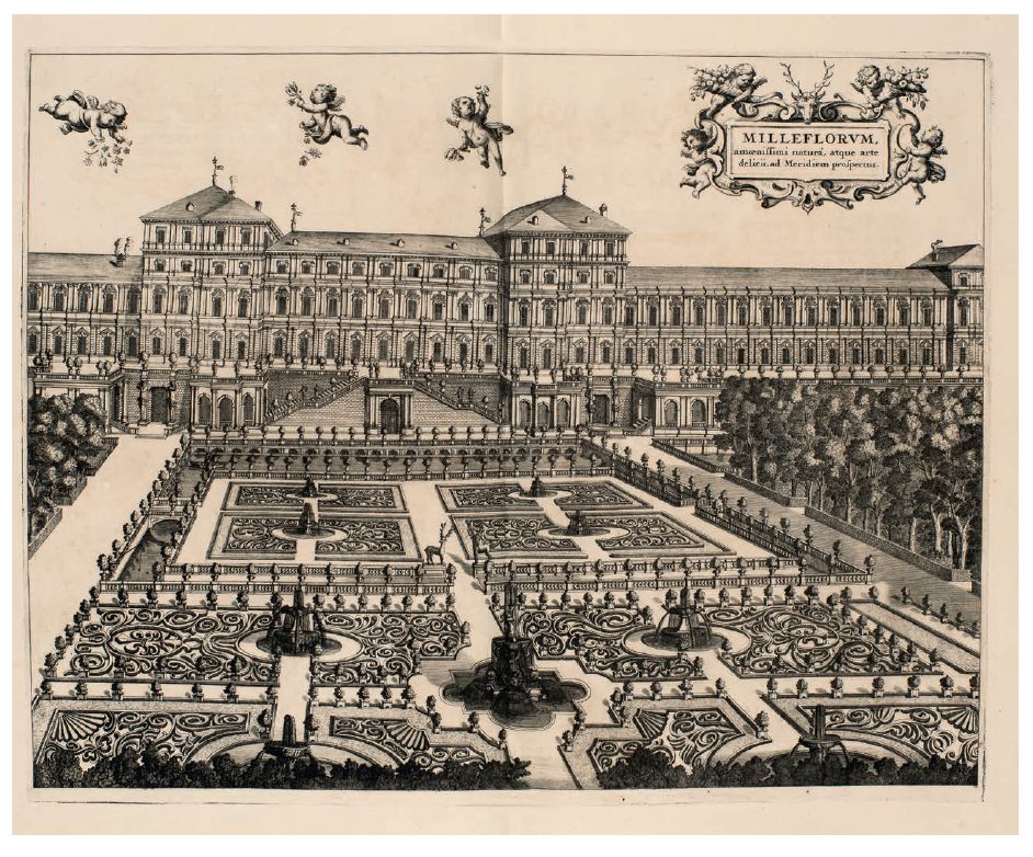
Every map and bird’s eye view (the kind most common among the engravings of the Theatrum) is preceded by an outline of the history of the place and description of the most important buildings and sights, focusing on the characteristics and identity of the region rather than serving any merely illustrative purpose.4
When the work was published by the Dutch printers, the regent was Marie Jeanne Baptiste of Savoy-Nemours and the duke her son Victory Amadeus II. They were both determined to carry on with the project despite the high costs and the difficulty of settling the bill for the fifty copies printed (the parties reached an agreement in 1692 for a payment of 600 pistole, equivalent to 10.610 lire). In their bid for visibility on an international scene now dominated by the France of Louis XIV, they did not hesitate to embellish and sometimes enlarge the appearance of the cities and places shown. For example, as is known, plate 32 depicts the Vigna di Madama Reale on the basis of lavish plans that were never actually carried through.5 It is also for this reason, in addition to the royal aspirations, which were not crowned with success until 1713, that historian Luigi Firpo spoke authoritatively of “images of a realm of dreams”.6
Blythe Alice Raviola
1 See the important two-volume edition of 1984 by L. Firpo for the Archivio storico della Città di Torino and in particular the contributions of A. Peyrot, “Le immagini e gli artisti”, vol. I, pp. 19-60, and vol. II, pp. 7-21, and I. Massabò Ricci, R. Roccia, “La grande impresa editoriale”, vol. II, pp. 63-92.
2 See Moorman 2015, pp. 70-79.
3 See P. Sereno, P. Pressenda, M. L. Sturani, “Re-interpreting a Monumentum cartographicum: the Theatrum Sabaudiae as a part of a representation system celebrating the sovereign’s power upon the land”, in Theatre of the World 2015, p. 124; see also Moorman forthcoming.
4 M. L. Doglio, “Le relazioni come documento letterario”, in Firpo 1984, vol. II, pp. 23-36.
5 Griseri 1988, pp. 153ff.
6 L. Firpo, “Immagini di un regno sognato”, in Firpo 1984, vol. I, pp. 9-14.